Redefining Precision: Drone Technology in Mapping and Surveying
Drone technology has come a long way since its inception. Today, drones are used for various applications such as aerial photography, videography, agriculture, mining, and delivery, among others. One of the most significant applications of drone technology, however, is in mapping and surveying. Drone technology has revolutionized mapping and surveying by providing high-resolution aerial imagery and data, making it easier and more accurate to map and survey large areas. In this article, we will explore how drone technology is redefining precision in mapping and surveying.
Mapping and Surveying: A Brief Overview
Mapping and surveying are two closely related activities that involve measuring, recording, and representing the features of the earth’s surface. Mapping involves creating maps of the earth’s surface, while surveying involves measuring and recording data about the earth’s surface to create maps. These two activities are essential for various applications such as urban planning, construction, mining, agriculture, and environmental management, among others.
Traditional mapping and surveying methods involve ground-based surveying techniques such as theodolites, total stations, and GPS. These methods are time-consuming, costly, and often provide limited data. For example, traditional surveying methods may not be able to capture data on steep slopes, dense forests, and inaccessible areas. Additionally, traditional surveying methods may not provide high-resolution data, making it difficult to capture small features such as vegetation, water bodies, and buildings.
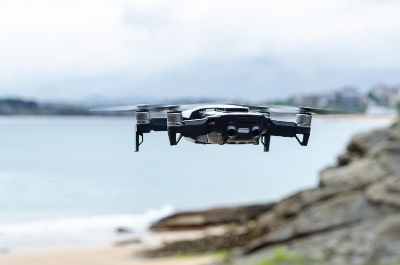
Drone Technology in Mapping and Surveying
Drone technology has revolutionized mapping and surveying by providing high-resolution aerial imagery and data, making it easier and more accurate to map and survey large areas. Drones, also known as unmanned aerial vehicles (UAVs), are aircraft that are operated remotely by a pilot or autonomously by an onboard computer. Drones are equipped with cameras, sensors, and other equipment that can capture high-resolution images and data of the earth’s surface.
Drones can be used for various mapping and surveying applications such as topographic mapping, cadastral mapping, photogrammetry, and LiDAR mapping, among others. Let us explore some of these applications in more detail.
Topographic Mapping
Topographic mapping involves creating maps that show the elevation and features of the earth’s surface. Topographic maps are essential for various applications such as urban planning, construction, and environmental management. Traditional topographic mapping methods involve ground-based surveying techniques such as theodolites, total stations, and GPS. These methods are time-consuming, costly, and often provide limited data.
Drone technology has revolutionized topographic mapping by providing high-resolution aerial imagery and data that can capture small features such as vegetation, water bodies, and buildings. Drones can capture images and data of the earth’s surface at different elevations, making it easier to create 3D topographic maps. Additionally, drones can capture data on steep slopes, dense forests, and inaccessible areas that traditional surveying methods may not be able to reach.
Cadastral Mapping
Cadastral mapping involves creating maps that show the boundaries and ownership of land parcels. Cadastral maps are essential for various applications such as land registration, land use planning, and property taxation. Traditional cadastral mapping methods involve ground-based surveying techniques such as theodolites, total stations, and GPS. These methods are time-consuming, costly, and often provide limited data.
Drone technology has revolutionized cadastral mapping by providing high-resolution aerial imagery and data that can capture small features such as property boundaries, buildings, and vegetation. Drones can capture images and data of the earth’s surface at different elevations, making it easier to create 3D cadastral maps. Additionally, drones can capture data on steep slopes, dense forests, and inaccessible areas that traditional surveying methods may not be able to reach. This makes it easier and more accurate to determine land ownership and boundaries.
Photogrammetry
Photogrammetry involves creating 3D models of the earth’s surface using aerial imagery. Photogrammetry is essential for various applications such as urban planning, construction, and environmental management. Traditional photogrammetry methods involve ground-based surveying techniques such as theodolites, total stations, and GPS. These methods are time-consuming, costly, and often provide limited data.
Drone technology has revolutionized photogrammetry by providing high-resolution aerial imagery and data that can capture small features such as buildings, vegetation, and water bodies. Drones can capture images and data of the earth’s surface at different angles, making it easier to create 3D models of the earth’s surface. Additionally, drones can capture data on steep slopes, dense forests, and inaccessible areas that traditional surveying methods may not be able to reach.
LiDAR Mapping
LiDAR mapping involves using laser scanners to create 3D models of the earth’s surface. LiDAR mapping is essential for various applications such as urban planning, construction, and environmental management. Traditional LiDAR mapping methods involve ground-based surveying techniques that are time-consuming, costly, and often provide limited data.
Drone technology has revolutionized LiDAR mapping by providing high-resolution aerial imagery and data that can capture small features such as buildings, vegetation, and water bodies. Drones can carry LiDAR sensors that can capture data at high speeds and resolutions, making it easier to create 3D models of the earth’s surface. Additionally, drones can capture data on steep slopes, dense forests, and inaccessible areas that traditional surveying methods may not be able to reach.
Benefits of Drone Technology in Mapping and Surveying
Drone technology provides several benefits for mapping and surveying, including:
- High-resolution data: Drones can capture high-resolution images and data of the earth’s surface, making it easier to map and survey large areas with precision.
- Cost-effective: Drone technology is cost-effective compared to traditional surveying methods, as it requires fewer personnel and equipment.
- Time-efficient: Drone technology is time-efficient compared to traditional surveying methods, as it can cover large areas in a short period.
- Improved safety: Drones can be used to survey dangerous and inaccessible areas without risking the safety of surveyors.
- Environmental-friendly: Drones can be used to survey sensitive areas such as wetlands and wildlife reserves without disturbing the environment.
Challenges of Drone Technology in Mapping and Surveying
Despite the benefits of drone technology in mapping and surveying, several challenges need to be addressed, including:
- Regulatory challenges: Drone technology is subject to regulations and restrictions that vary from country to country, making it challenging to use drones in some areas.
- Technical challenges: Drone technology requires specialized skills and equipment, making it challenging for some surveyors to adopt this technology.
- Data processing challenges: Drone technology produces large volumes of data that need to be processed and analyzed, making it challenging for some surveyors to manage and store the data.
- Safety challenges: Drone technology requires strict safety protocols to ensure that drones do not collide with other aircraft or objects.
Drone technology has revolutionized mapping and surveying by providing high-resolution aerial imagery and data, making it easier and more accurate to map and survey large areas. Drones can be used for various mapping and surveying applications such as topographic mapping, cadastral mapping, photogrammetry, and LiDAR mapping. Drone technology provides several benefits for mapping and surveying, including high-resolution data, cost-effectiveness, time-efficiency, and improved safety.